Thursday, April 14, 2011: Warwick, MA: Formerly Gardiner’s or Roxbury, Canada

Heading west on Hwy 117 I merged onto I-90 for 1.5 miles and then it became Hwy 2 (George Stanton Hwy) past Leominster, Fitchburg, Westminster, Gardner, East Templeton.  I decided to not take a chance on road construction so I turned at Athol onto Hwy 32 and drove along through Athol and Orange.  I found Athol to be a lovely town with stores and shops and I would have liked to dally more but I had an appointment to get to and I was already a little late. I turned north on Hwy 78 and headed for Warwick, MA. I love Massachusetts.  You are where you want to be in no time.  

Warwick was at one time known as Gardiner’s Canada or Roxbury Canada. This is where the cousin Philip Goss who married Hannah Ball migrated to.  This Philip Goss 1720-1804 was a half 1st cousin once removed of my Philip Goss IV 1724-1778 who married Mary Kendall. 

Here is a chart that might help clarify the relationships of these Philip Goss’ that caused quite a mixed up.

First Generation:
PHILIP (1) GOSS, the Immigrant Ancestor of
ca 1654 to 1698
Roxbury and Lancaster, Massachusetts
Buried Old Settlers Burying Field, Lancaster
Married 1st, Hannah Hopkins
Married 2nd Mary Prescott
2nd Generation
PHILIP (2) GOSS 1676-1747
Married Judith Hayward
Buried Old Indian Cemetery, West Brookfield
JOHN (2) GOSS b. 1/20/1693 d. abt 1743
Married Mary
Unknown burial place
3rd Generation
PHILIP (3) GOSS b. ca 1700 d 1742
Married Keziah Cooley
Unknown burial place
PHILIP (3) GOSS, b. circa 1720 at Lancaster, MA.
Married Hannah Ball
Evergreen Cemetery, Winchester, NH
4th Generation
PHILIP (4) GOSS, “of BROOKFIELD
1724-1778
Married Mary Kendall of Lancaster
Unknown Burial location, Mary is in the Scott Cemetery in Luzerne Co., PA
PHILIP (4) GOSS, of Montague, Massachusetts.  1757-1840
Married Esther Gale
Burnham Cemetery, Montague, MA
5th Generation
PHILIP (5) GOSS, Jr., Harveyville, Pennsylvania 1787-1870
Married Hannah Derby
PHILIP (5) LAMPSON GOSS of Brighton, Ohio 1799 to 1878
Married Serena Stella Porter

The Town of Orange came very quickly and I was soon on Hwy 78 going north.  The Warwick sign was there within minutes but it took several miles to get to the town center.  Everything is very close in Warwick.  There is a triangle shape in the center of the town. The Warwick Library is on the northeast side while the  town hall is right next door to the Warwick Historical Society.  They are right there on the southwest corner. 

Larry Carey, President of the Warwick Historical Society was waiting patiently for me at the door.  I had called to let him know I would be slightly delayed. 

Warwick Historical Society & Museum

Warwick Library

Warwick Town Hall

He had a land map for me of the settlers. He gave me their last copy. I had a description of the land that Philip Goss purchased:

Philip Goss acquired land in Warwick, as witnessed in a document in the New Hampshire County deeds, June 10, 1763.  Joseph Williams of Roxbury, Suffolk Co., Mass. Yoeman, a Lot in Warwick, 150 acres, the 66th Lot in the 2nd Division.”  Vol. VI, p. 183 Hampshire Deeds. 

Warwick is now in the county of Franklin and the Registry of Deeds for Franklin is in Greenfield.  In order to find this deed I would need to look in the Hampshire County deeds.  The Registry of Deeds for Hampshire County is in Northampton.  According to the Registry of Deeds in Greenfield they do have abstracts of the Hampshire Co. deeds that are before Franklin Co. was established. 

We found the 66th lot in the 2nd division and that is the land that this cousin Philip Goss purchased when he came to Warwick.  Larry didn’t know where things were on the map till I pointed out Morse Lake and then he knew immediately.  When he realized where the land was he told me that at this time today there are no roads back in that area. 
The Warwick Historical Society is doing a wonderful job of adding their holdings to their website.  You have to go and see it.  There website made me laugh.  It is really hard to know the date of some document or record and they are at least honest when they write they don’t know.  The point is they are making an effort to get their holdings online for all to review.  http://www.warwickma.org/history.html

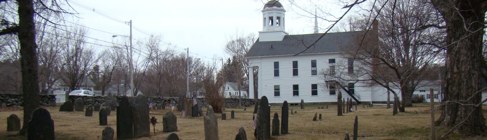
The Warwick Cemetery – Anna Goss has been documented by the Warwick Historical Society and you can also get a listing at Find A Grave. There is one Goss name in this cemetery. Click on the link to the Warwick Cemetery and see the tombstone of Anna Goss.  What her relationship is? Well, I don’t know at this time?


Warwick Cemetery, Warwick, Franklin Co., MA


Now this Philip Goss was a restless man and he didn’t stay long in Warwick but headed north into New Hampshire.  That was my next goal.

Warwick Directions Sign

Thursday, April 14, 2011: Nights Pasture, Lancaster

By the time breakfast came at the College Town Inn I was packed and ready to go.  I had to reschedule some activities in the morning before leaving Lancaster because of the pouring rain the day before. 

My first goal was the find the “Night’s Pasture” area in Lancaster.  I had attempted it the day before but was just not getting the right feel for the geography.  Marsha, of the Special Collections, at the Thayer Memorial Library, suggested Center Bridge Road.  I decided to try it and low and behold there was the Nashua connecting to the North Branch? I was so happy!!!! Marsha also explained that the area was used for growing corn. 

There is a map in the book written by Henry S. Nourse on page 264 and also 266 that is a drawing of the lands of the old settlers.  The book is the Early Records of Lancaster 1643 to 1725, by Henry S. Nourse, 1884.  This book is at Google Books but that copy has bad pages in it.  Fortunately the maps are in tack.  They are really wonderful and there is an area at the confluence of the North branch and the Nashaway River that is right were  one of the areas of Joseph Rowlandson’s titled the “Nights Pasture.”  This is part of the lands that Philip Goss I (1654 to 1698) purchased in 1687. 

Do not expect much.  It is a large open area without much there.  A road has been added since and a bridge.  Just know that I could tell through the trees that the North Branch and the Nashaway were coming together.  They were not turbulent but serene as they merged! 

Southwest side of the Center Bridge

More Southwest Side
Still more south side
Nashaway River Southeast


Trying to show the meeting of the North branch with the Nashaway

Southeast


Coming from the northwest


Trying to even more show where the North branch meets the Nashaway River


Northeast from the road to the field


Southeast side of the bridge North branch

The field from the road looking northeast on the west side of the bridge

Field area looking north

The field area looking northeast

What is a “Nights Pasture?”  Well, Nourse talks about that in the same book and it is rather fun to read.  The nights pasture was for the animals to go at night.  See page 299 for more information about the night pasture and enjoy Nourse’s explanation. 

Oh, the Great Elm Historical Marker is just east of this area? 

The next stop was the marker for the Rowlandson Garrison which would be more of the Joseph Rowlandson land ownings.  I found it where the opening is in the stone wall along Main Street before you get to the cemetery which is on the left.

I again refer you to the maps in Nourse’s book I mentioned about.  Have Fun!

Wednesday, April 13, 2011: Lancaster Wanderings I – Rowlandson Rock, Goss Lane

Breakfast is included at the College Town Inn.  This is a Bed and Breakfast and the architecture is more modern.  I usually prefer the old creaky houses.  This was nice and I am enjoyed my stay.  My room was comfortable and I had an outside entrance.  I have never had that in a B&B!
The owners are very nice and we chatted at breakfast about my research.  The decor is a “little bit country” but very clean and tidy.  The house is a maze so you do have to pay attention.  The breakfast room is large and could be used for other functions.  Charlotte was born in the area and Jack is from Pennsylvania.  He said they had been here since 1957.  WOW!

I spent the morning catching up with the journaling and blog and it is taking a lot of time.  It was also raining heavily and I was hoping it would get better….dreamer….!!

Just as soon as I loaded the car it started to pour.  I mean POUR….AUGGGGH!!!!!  Rain Rain Go Away…!!  Not while I am in Lancaster!!!!!

So I sat in my car a while but the rain was not going to give up.  Eventually I made the decision to go ahead and look for sign posts and historical markers and things I could do without getting too wet. Hopefully it would let up.  Hmmmm……!  According to the weather report the worst part of the rain would be this evening…maybe this was the evening storm earlier than planned?  Hope, Hope….!!!

Rowlandson Rock, Lancaster, Massachusetts

Rowlandson Rock is on George Hill and there is a George Hill Road.  So I turned off Main Street to the right and came to a dead end. It was closed!!! Apparently a section of the road sunk for I could see a lake in the middle of the road on the other side of the cement barricade.  It meant you had to go around.  I did that using Prescott St. and turned on Langen St. and went up George Hill Road realizing that I was on the wrong side of the hill and Windsor Rd, the entrance, was around the other southern side. 

Prescott St in Lancaster

I found Windsor Road and proceeded up the road to two stone pillars with lights on the top and a small expanse of rock fence on both sides.  I drove through and found a big yellow house on the right and the blue water towers in front of me with a chain link fence and a locked gate.  I drove to it but was puzzled as to what to do next?  There was absolutely no signs to direct you.  The idea of slogging around trying to find the site in the pouring rain was not something I was eager to do.

How to Get to Rowlandson Rock!!

Do not take the road to the right for that is the yellow house’s lower garage area.  Do not take the next road to the right for that is the yellow house’s front parking area.  Go ahead to the chain link fence gate and park.  There is a path to the left.  Hopefully the person who parked the green tractor across the path entrance has moved it? If not the path is probably blocked by the tracker.  Look to the left for rocks stacked like a short fence or indicating a path and you will find a path to Rowlandson Rock. 

You will have to walk like a half block to it but it is easy.  It is to the left which is probably the west.  The rock is around the water tanks a little north of them. As soon as you get on the path you will spot the site and it is a no brainer from there.  It is a nice wooded area.  There is a plaque that is starting to peel but the rocks are there. 

I would have taken a picture of myself at the rock but it was raining so hard I had my blue slicker on and was trying to protect my camera and as you can see from the photos raindrops got on the lens.  My slicker pockets were filling up with rain running off the slicker.  It was not fun.  I wish I had my knit gloves that were in my coat pocket that I left behind! Sigh!

The Road to the Water Towers. Note the Tractor blocking the path!

See the bit of blue and the path on the left!

Rowlandson Rock and sign

The sign with raindrops!!!!

Rowlandson Rock has nothing to do with the Goss History except it is the setting for what is to come.  After this terrible incident during King Philip’s War 1675, the Rowlandsons didn’t stay in Lancaster and Philip Goss I purchased the Rowlandson Estate in 1687 and that deed started a chain of events that has lead the migration of the Goss family west.  It is also a very big part of the early Lancaster history and I love all kinds of history. 

There is a book by Mary Rowlandson about her ordeal:  A Narrative of the Captivity, Sufferings and Removes of Mrs. Mary Rowlandson, 1791.  It has been reprinted and rearranged several times.  Google Books has a copy.  There may be a movie about this someday according to a reliable source?

Take a little time and drive around George Hill Road and Hilltop Road in Lancaster it is very lovely up there.  There are some fine homes there and what I would call estates.  There is a house, barn and more in pink!

Goss Lane, Lancaster, MA
There is supposed to be a Goss Street in Clinton off Main Hwy 70 at Roma St and Laurel St. The street that connects them is Goss St.  Charlotte of the College Town Inn said there was the “Goss Lane” in Lancaster. 

Well I traveled all over the place till I realized that the Langen Road becomes the Goss Lane.  I had tried the Sterling Road entrance (no sign) but there are two large signs that say “DO NOT ENTER” a little ways from the entrance.  When I finally figured it out and spotted the sign “Goss Lane” which was the only one I could find, I realized it was directly across from the blockage to the George Hill Road.  HA!  I do feel a bit silly about it all but it can be confusing in a new area. 

My curiosity taking hold I drove the whole Goss Lane and sure enough I found the two signs I mentioned earlier.  I might venture a 1/4 mile? (Where’s my hubbie when I need him!) Apparently they are trying to discourage through traffic.  It is a narrow road the Goss Lane.  As you drive south on it you move from a large pasture on the right with houses on the left and then into a valley between two hills with trees and lovely homes nicely situated apart from each other on a winding road up an down and around.   It is lovely along Goss Lane. 

Goss Lane, Lancaster
Well I did eventually stumble upon the 2nd Rowlandson Rock Sign.  It is on the right as you turn onto Sterling Road.  I am still looking for other signs which are eluding me at this time?


Time for lunch.  Sandee’s was right there when I came out from my excursion on the Goss Lane.  I remember it from the Internet.  My grilled cheese sandwich was good comfort food.  They are not open for dinner which is too bad.  The food was delicious and very good in price. 

I swear it rained till I decided to get lunch about 12.30 pm and then it stopped for awhile.  So I was eating at Sandee’s along Main Street and I couldn’t leave, well I suppose I could have taken my sandwich with me?  Hmmm…..!
The Site for the Great Elm is on Central Bridge Road before you get to the bridge and after the Five Corners.  Apparently it was a very special tree to have live as long as it did.  

The rain was still coming down but lighter and I just could not wait any longer and headed for the Middle Cemetery to do what I could, after all I am a veteran Seattlelite and know rain…off I went!